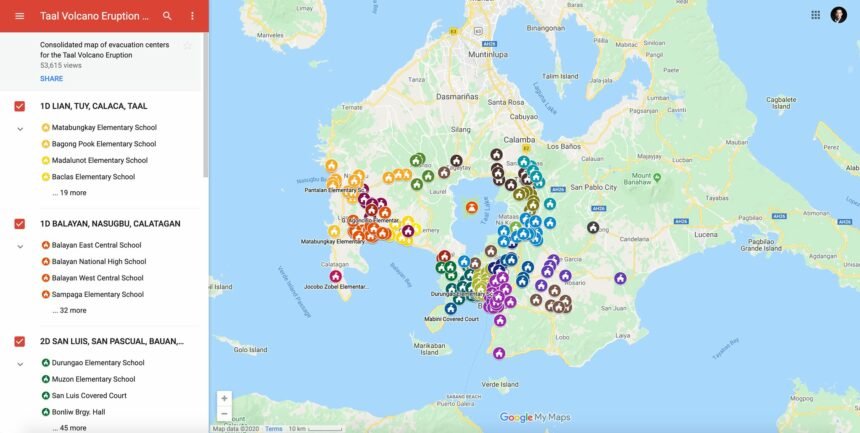
Google Philippines has just released a consolidated map of centers with regards the Taal Volcano eruption for people who need to find shelter or want to send help.
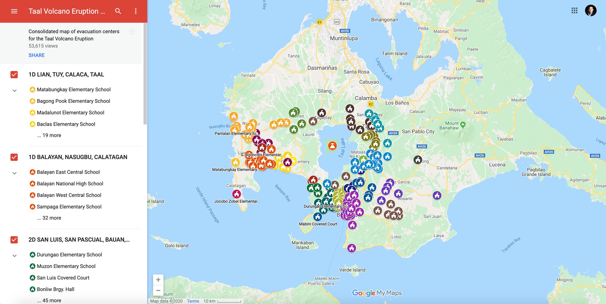
Through the help of volunteer mappers and with information sourced from the Batangas Public Information Office, Google has made a consolidated map of evacuation centers related to the eruption. We hope that this can be useful for those who need shelter, rescue and assistance, as well as for people who are looking for ways to help.
The consolidated map directs viewers to relevant locations for the following:
- Taal Volcano Eruption Evacuation centers
- Centralized drop off points for relief goods
- Contact points for evacuation of animals
- Road closures due to fissures
- Health related POIs
Alternatively, Search can also be used to find this map:
- Google Search “Taal Volcano”.
- Scroll down below among the Search results to see and tap “View on map” under “AFFECTED AREA”.
- Tap “Layers”.
- Tap “View in Google My Maps”.
The map can also be accessed on Google’s social media page.
To help report critical information or to enlist more evacuation centers, please send an email to phmappers@gmail.com.
Source: Google